Wildfire Simulation
predicting and preventing wildfire spread
Our wildfire tool kit is faster and smater than the fire. This modelling and simulation software can predict how fire will spread under different conditions on any kind of terrain at any point in the world, in the future, present, past and in all alternative universes. By analysing critical regions, you can be better prepared. If a fire has already broken out, we can run a quick simulation of that area. It will tell you how to distribute your fire fighting forces efficiently and which areas to evacuate. Our software is constantly validated using data from previous fire events. It can adapt to changing weather conditions and update its predictions in real time.
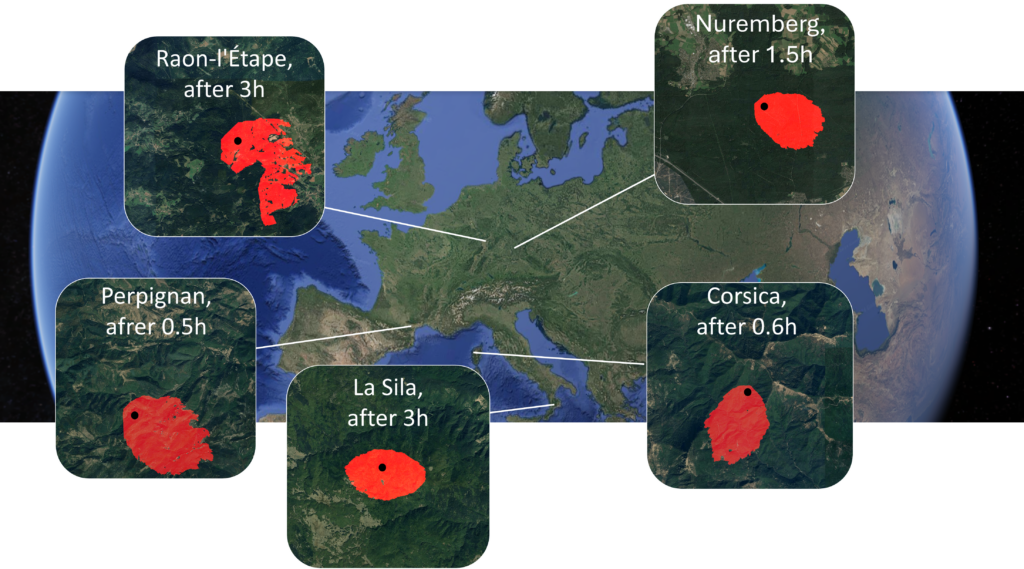
Examples: Prediction of wild fires in different parts of the world

Here are some examples of how fire spread can vary depending on local geological features, vegetation, and weather conditions. In cases of strong wind, the affected area is often skewed in one direction. Additionally, the absence of dense forest can act as a natural barrier. When comparing the examples in Corsica and La Sila, you can see that the spread rate can also be significantly impacted by external factors such as humidity and slope inclination. We continuously train our solver using data collected from past fires. A primary challenge in this process is the dynamic effect that active firefighting efforts have on the spread of the fire. To address this, we apply custom-developed statistical filters that reduce the uncertainties.
Technology: Solver structure and data management

This graphic demonstrates what information our software retrieves from global databases and how it combines it to generate a foundation for the solver. A thorough analysis of the available data is the most important basis for reliable simulations. Data on the geological profile and local weather conditions is relatively easy to obtain. However, determining the burning characteristics of local vegetation is a multi-dimensional process, primarily based on satellite data. This is one reason why the satellite cartography industry has become highly profitable. Today, multispectral measurements with resolutions as fine as 30 meters are available for any location on the planet. Accurate interpretation of this data significantly impacts calculations of local fire spread velocity and hence the spread prediction.

